Home

Patrick's Packrafting Adventures


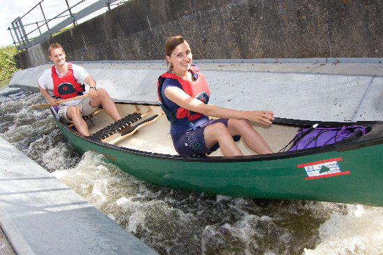
A packraft is a small, portable inflatable boat, designed to be light enough to be carried for extended distances. Boats of this description have been used for over a century, but in recent years the designs have been optimised, mass produced and packrafting has developed as an outdoor activity. When I came across videos online of people using packrafts, I immediately recognised the potential for expanding the scope of my adventures.

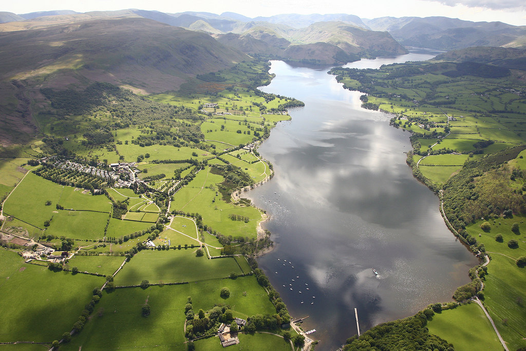
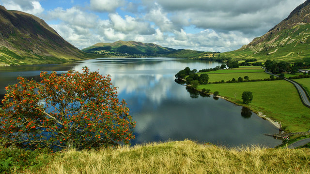
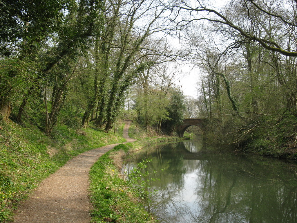
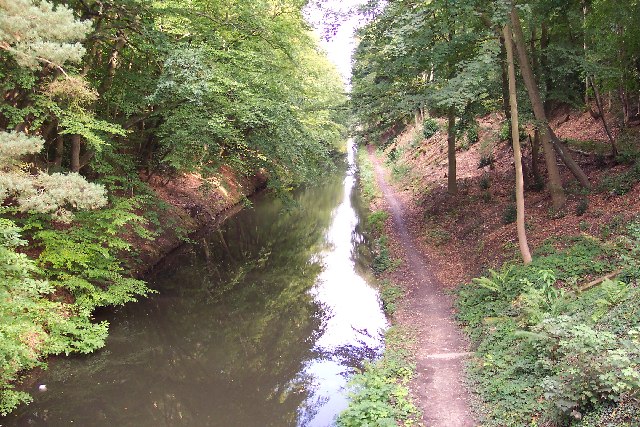
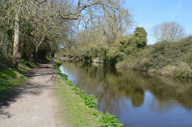
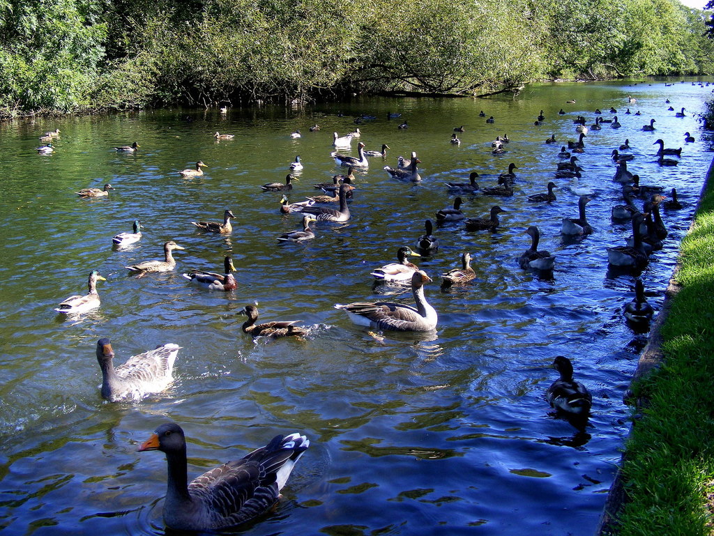
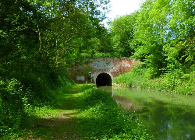
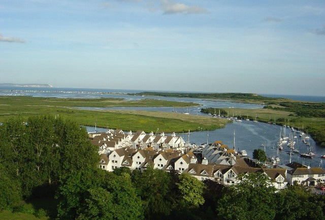
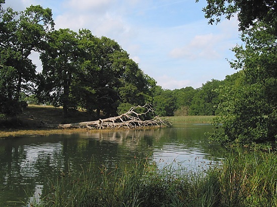
I was in the sea scouts while growing up and have always had an affinity with the water. However, I don’t own a car, so participation in watersports in adult life hasn’t really been feasible. A packraft is a game changer because it can be easily taken on public transport, which therefore allows me to do weekend excursions along the canals and rivers of southern England; anywhere within a few hours journey from my home in Southampton. More ambitious multi-day trips are also possible, such as river descents, and combined land/water traverses through any landscape that features lakes in close proximity (the English Lake District, Mid & North Wales and much of the Scottish Highlands).

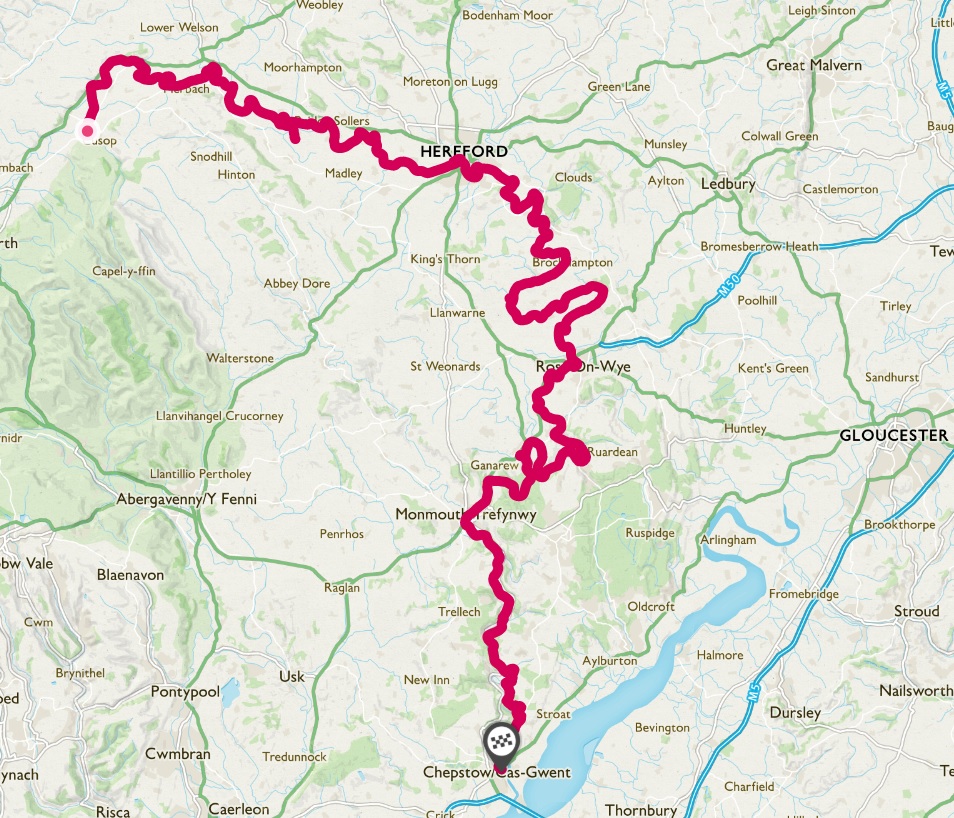
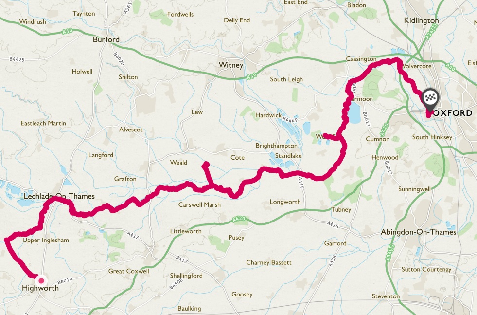
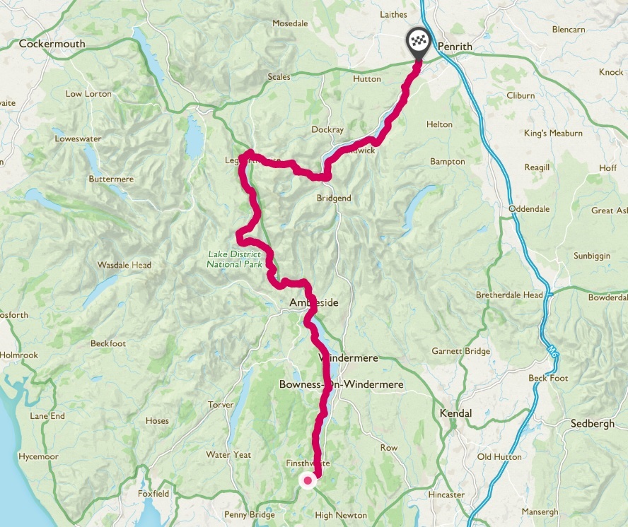
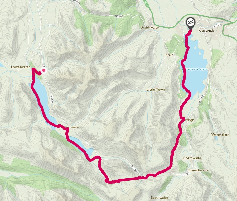
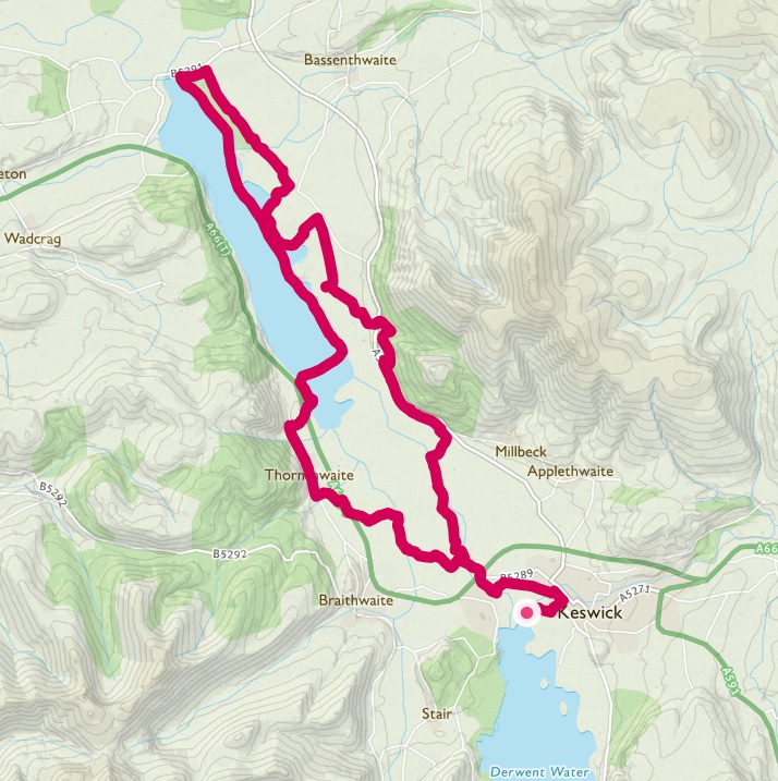
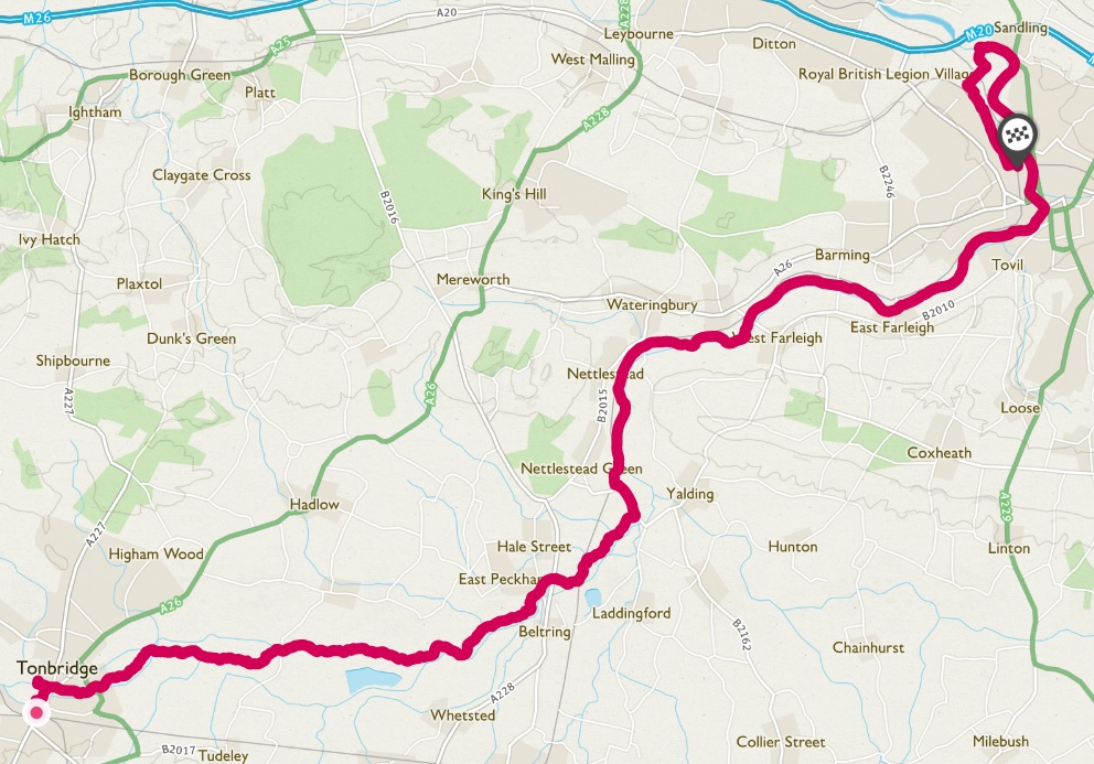
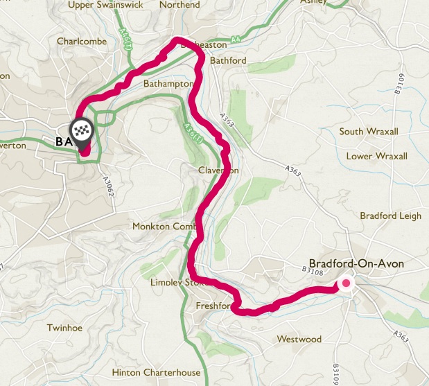
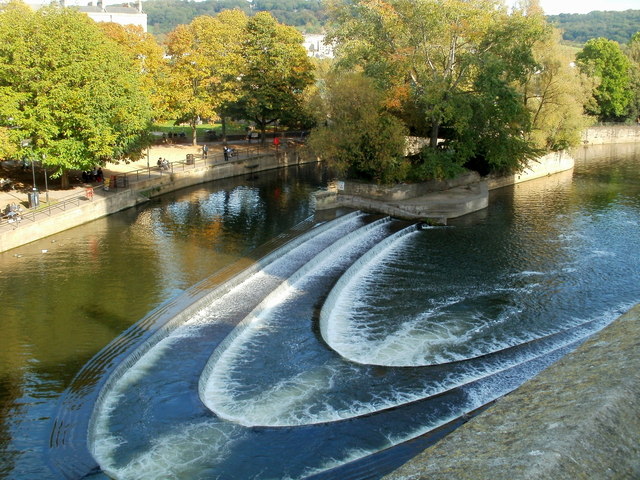
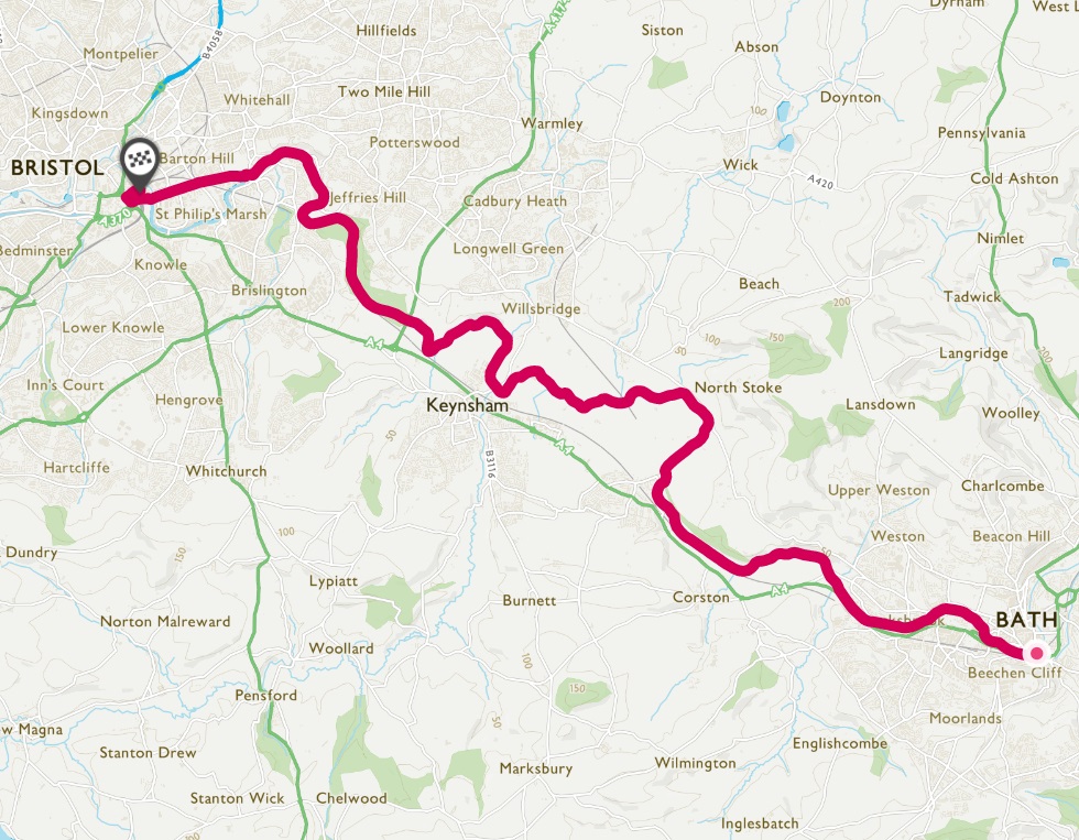
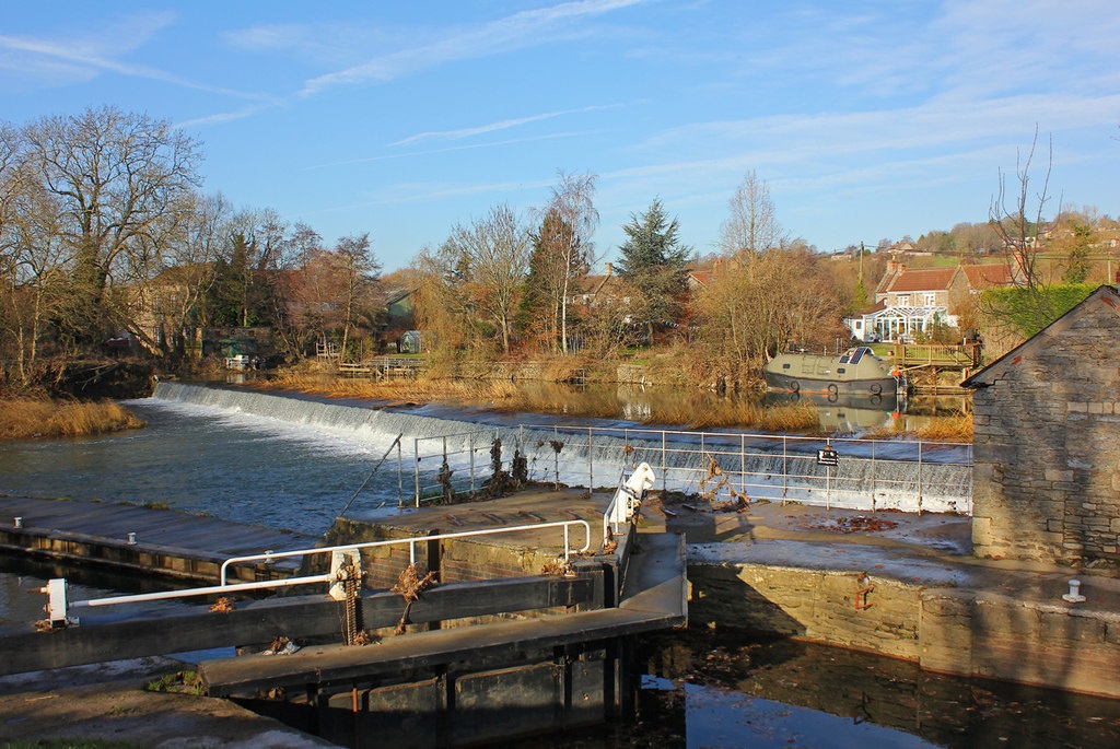
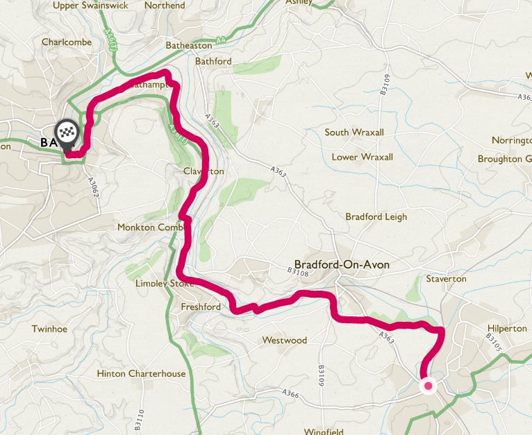
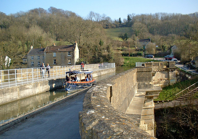
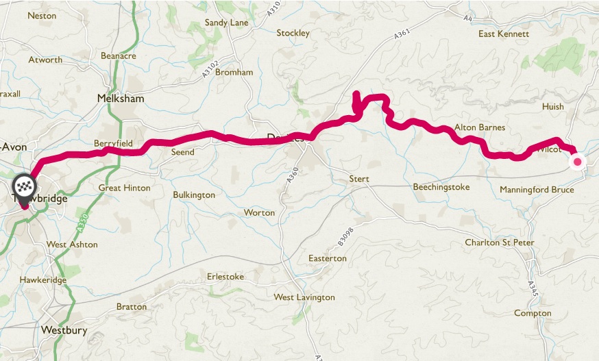
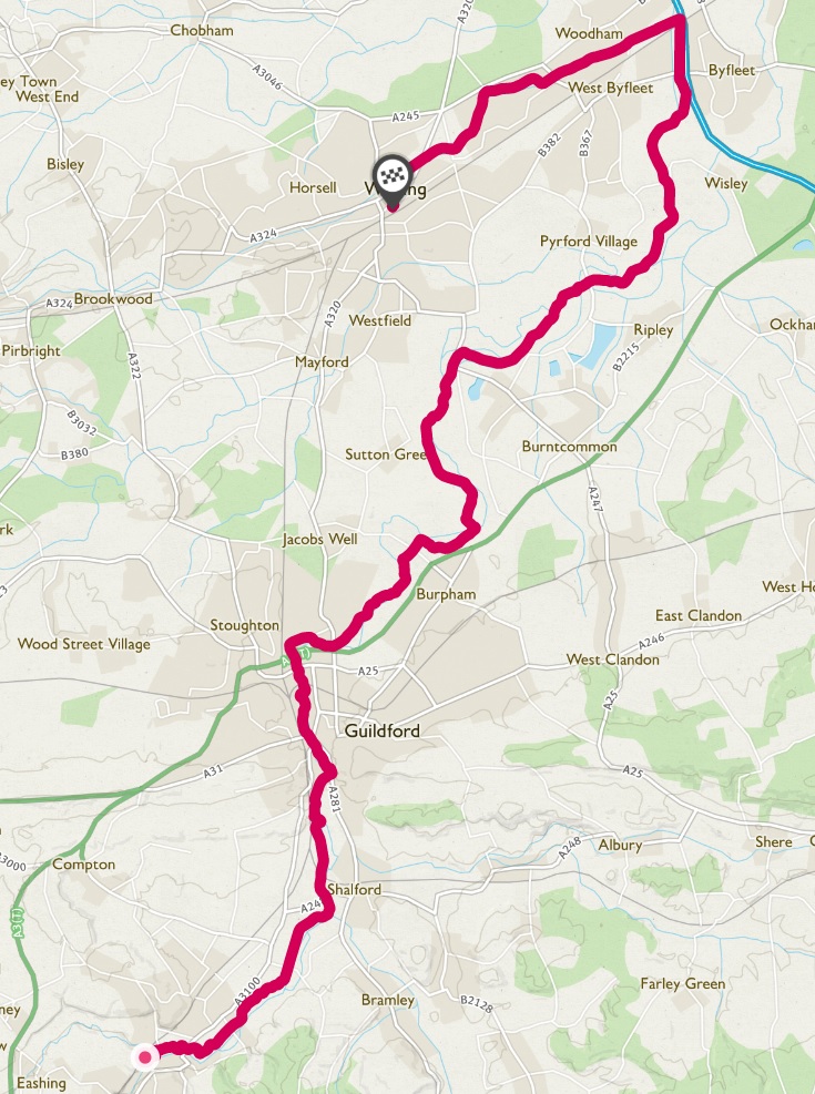
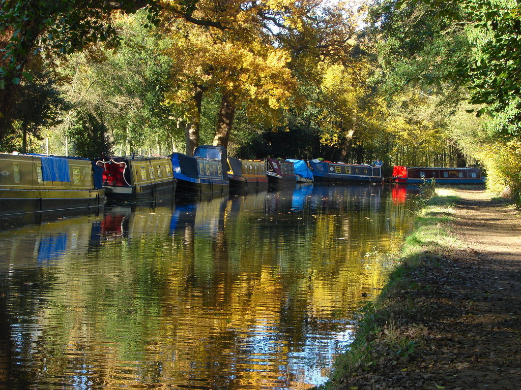
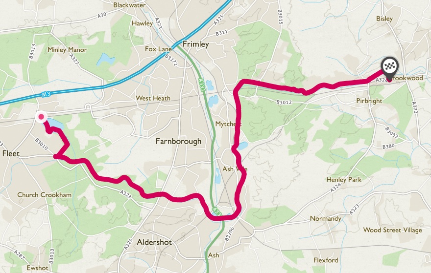
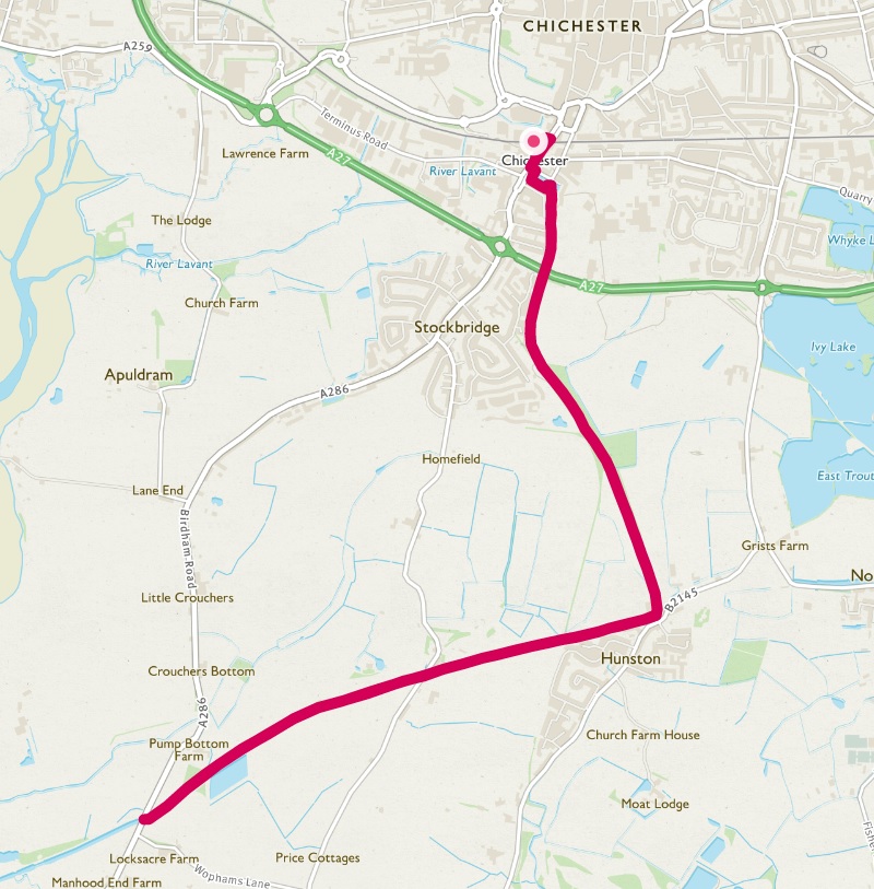
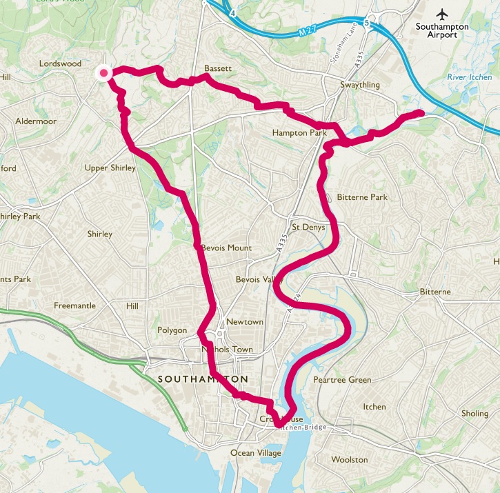
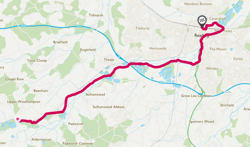
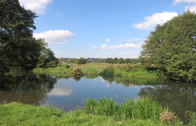
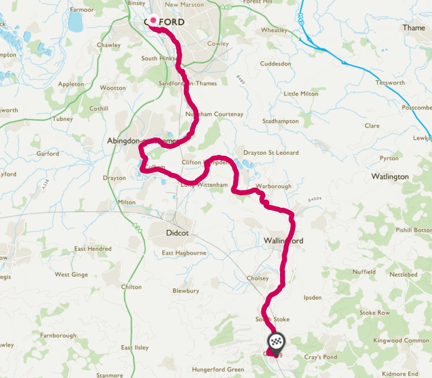
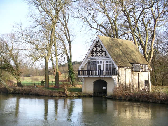
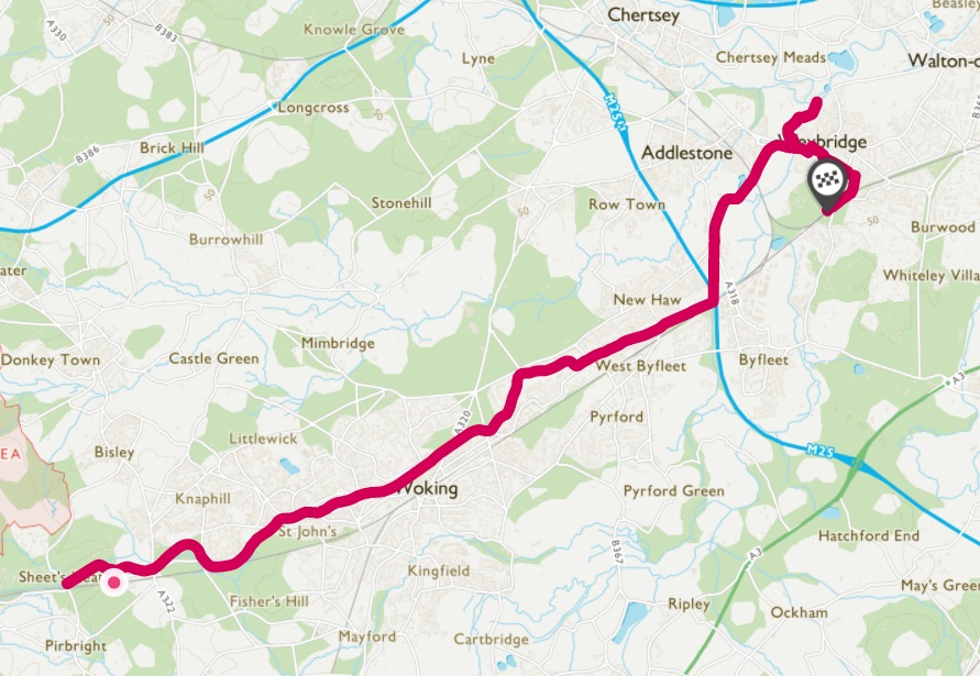
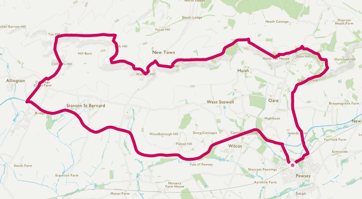
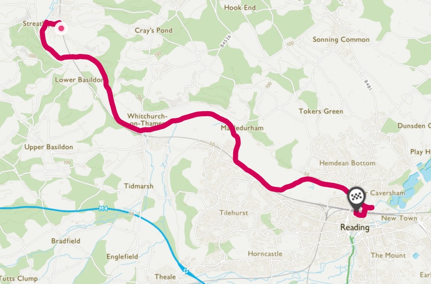
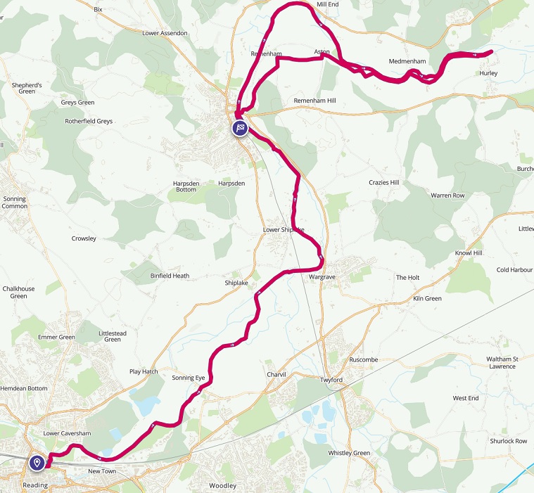
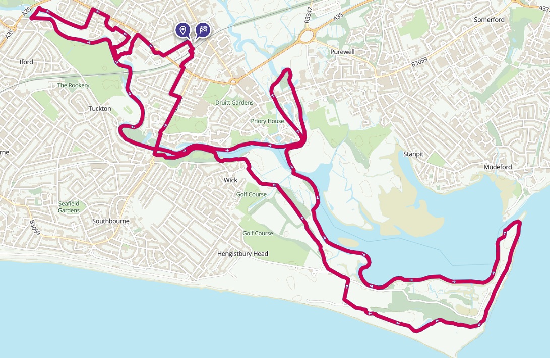
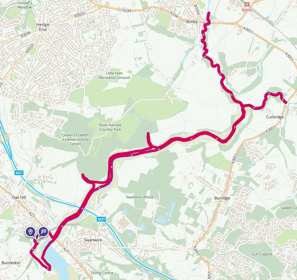
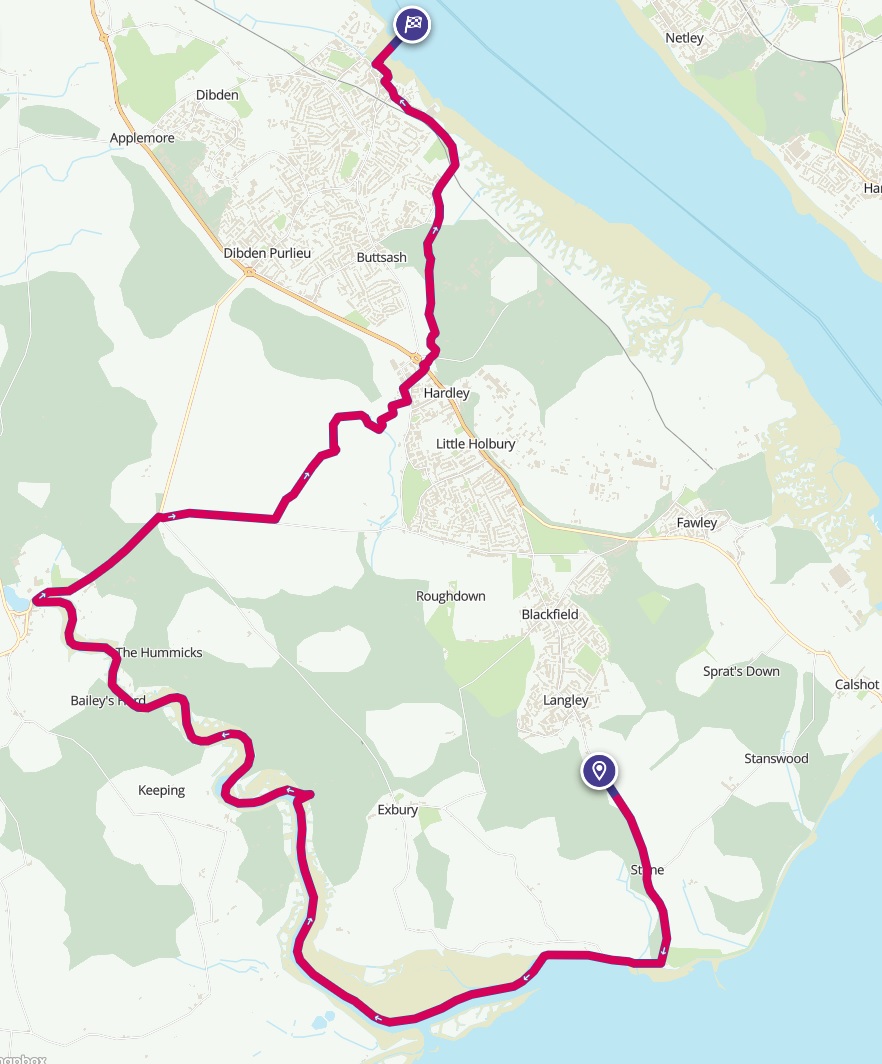
Following extensive research online I purchased a packraft, paddle and buoyancy aid from the Anfibio Packrafting Store in Germany. Click here for a review of the gear I use. Below there are details of the packrafting routes that I’ve done so far. The routes are all available in OS Maps, and the GPX routes can be downloaded. I’ve provided sufficient notes to enable the routes to be easily repeated, but unlike my other adventures I haven’t written detailed trip reports or taken photographs. Such things take a lot of time, and I’d rather be outside than in front of a computer!


Contains OS data © Crown copyright and database rights 2023

Packrafting on the River Wye: Hay-on-Wye to Chepstow 7 Day Camping Trip

The River Wye is often said to be Britain’s finest canoeing river. Between Glasbury and Chepstow there are 100 miles of natural easily graded water, suitable for multi-day river tours. In normal summer levels the river is straightforward with most rapids at grade 1. There are a couple of grade 2 rapids, which can be portaged if necessary.

I started 5 miles downstream from Glasbury at Hay-on-Wye, then finished paddling seven days later at Bigsweir Bridge, staying at campsites along the way. It's possible to continue downriver to Chepstow, but this is more serious with high muddy banks, no intermediate landing places and dangerous weirs exposed at low tide. The tide was out, so I opted to walk the final 11 miles to Chepstow following Offa's Dyke path.

Click on the map for more details of the route in OS Maps.

Photo © Philip Halling (cc-by-sa/2.0)

Contains OS data © Crown copyright and database rights 2023

Packrafting on the Upper River Thames/Isis: Highworth to Oxford 4 Day Camping Trip

A four day packrafting trip down the upper reaches of the River Thames/Isis to Oxford. This part of the Thames is peaceful and idyllic, with scenery straight out of The Wind in the Willows. The upper river is narrow, fast-flowing and can be blocked with fallen trees up to the first lock at Lechlade. Beyond here there are locks every few miles, the lock keepers are generally happy to let small craft through, although it's always possible to portage around, plus there's a new canoe pass at Radcot Lock. There are plenty of campsites and pubs serving food available along the way.

Click on the map for more details of the route in OS Maps.

Route requires a British Canoeing Waterways Licence or equivalent.

Photo © Andrew Smith (cc-by-sa/2.0)

Contains OS data © Crown copyright and database rights 2023

Packrafting in the Lake District: Windermere to Ullswater 4 Day Through Trip

A four day packrafting trip paddling the full length of Windermere and Ullswater, the two largest lakes in the Lake District, plus Rydal Water, Grasmere and Thirlmere. I wild camped for two nights and stayed at an official campsite in Glenridding. Food is available in Ambleside and Glenridding.

Click on the map for more details of the route in OS Maps.

Photo © Richard Bird (cc-by-sa/2.0)

Contains OS data © Crown copyright and database rights 2023

Packrafting in the Lake District: Crummock Water, Buttermere and Derwent Water 2 Day Trip Staying Overnight in a Bothy

A two day packrafting trip starting from Keswick in the Lake District. Paddle Cummock Water and Buttermere on the first day, followed by a night in Warnscale Head bothy, then on the second day cross Honister Pass, descend Borrowdale and paddle Derwent Water back to Keswick.

Click on the map for more details of the route in OS Maps.

Boating permit for Buttermere and Cummock Water available from the National Trust car park in Buttermere village.

Photo © Mick Garratt (cc-by-sa/2.0)

Contains OS data © Crown copyright and database rights 2023

Packrafting in the Lake District: Bassenthwaite Lake Circuit

A one day circuit of Bassenthwaite Lake, the northernmost lake in the Lake District, starting from Keswick. A good place to get away from the crowds around the more popular lakes. On my visit the wind was coming from the northwest, so I walked from Keswick along the quiet east shore to the north end of the lake and then paddled back with the wind mostly behind me.

Click on the map for more details of the route in OS Maps.

Boating permit available from Moot Hall Tourist Information Office in Keswick.

Photo © Bob Jenkins (cc-by-sa/2.0)

Contains OS data © Crown copyright and database rights 2023

Packrafting on the River Medway: Tonbridge to Allington

The facilities provided by the Environment Agency on the River Medway make it one of the best rivers for paddlers in the south of England. The Medway Canoe Trail has slipways at its start and end, low level landing stages at all the locks making them easy to portage if required and uniquely a series of canoe passes/chutes that make it easy to travel downstream avoiding most of the locks entirely.

The canoe trail is 18 miles long and challenging to do in a single day, but there are railway stations at regular intervals so it can be easily shortened, or completed as a two day trip, camping at one of the free campsites or at The Hop Farm campsite.

Click on the map for more details of the route in OS Maps.

Route requires a British Canoeing Waterways Licence or equivalent.

Photo © Environment Agency (cc-by-sa/2.0)

Contains OS data © Crown copyright and database rights 2023

Packrafting on the River Avon: Bradford-on-Avon to Bath

A one day packrafting trip along the River Avon from Bradford-on-Avon to Bath. The river flows through a deep wooded valley in a beautiful surrounding landscape. There are five weirs to negotiate, some are tricky, descriptions are provided with the route.

Click on the map for more details of the route in OS Maps.

Photo © Jaggery (cc-by-sa/2.0)

Contains OS data © Crown copyright and database rights 2023

Packrafting on the River Avon: Bath to Bristol

A one day packrafting trip along the River Avon from Bath to Bristol.

Click on the map for more details of the route in OS Maps.

Route requires a British Canoeing Waterways Licence or equivalent.

If continuing through Bristol Floating Harbour a day or annual licence is required (technically this is also needed for the River Avon between Hanham Lock and Netham Lock). A licence can be purchased in person from the Bristol City Council Harbour Office, Baltic Wharf, BS1 6XG, and proof of insurance will be needed.

Photo © Wayland Smith (cc-by-sa/2.0)

Contains OS data © Crown copyright and database rights 2023

Packrafting on the Kennet and Avon Canal: Trowbridge to Bath

A one day packrafting trip along the Kennet & Avon Canal from Trowbridge to Bath. One lock to portage around at Bradford on Avon. The route is very scenic, with the canal contouring along the sides of a deep wooded valley, crossing from one side to the other at the Avoncliff and Dundas Aqueducts. There are two short tunnels towards the end as the canal enters Bath.

Click on the map for more details of the route in OS Maps.

Route requires a British Canoeing Waterways Licence or equivalent.

Photo © P L Chadwick (cc-by-sa/2.0)

Contains OS data © Crown copyright and database rights 2023

Packrafting on the Kennet and Avon Canal: Pewsey to Trowbridge 2 Day Camping Trip

A two day packrafting trip along the Kennet & Avon Canal from Pewsey to Trowbridge, camping at the Crown Inn, Bishops Cannings at the end of the first day. The canal is lock-free up to Devizes on the second day, beyond which there's a long portage around the Caen Hill Locks and two further groups of locks before Trowbridge.

Click on the map for more details of the route in OS Maps.

Route requires a British Canoeing Waterways Licence or equivalent.

Photo © Christine Johnstone (cc-by-sa/2.0)

Contains OS data © Crown copyright and database rights 2023

Packrafting on the Godalming and Wey Navigations: Godalming to Woking

A challenging one day 17 mile paddle down the River Wey and Godalming Navigations from Godalming to Byfleet, finishing with a walk up the Basingstoke Canal to Woking. The navigations are owned and managed by the National Trust. In general the route is leafy and rural, although for a few short sections there's noise from the A3 and the M25. There are ten locks to portage around on the route.

Click on the map for more details of the route in OS Maps.

Route requires a British Canoeing Waterways Licence or equivalent.

Photo © Alan Hunt (cc-by-sa/2.0)

Contains OS data © Crown copyright and database rights 2023

Packrafting on the Basingstoke Canal: Hook to Fleet

A one day packrafting trip along the Basingstoke Canal from Hook to Fleet. No locks along this entire stretch.

Click on the map for more details of the route in OS Maps.

Route requires a British Canoeing Waterways Licence or equivalent.

Photo © don cload (cc-by-sa/2.0)

Contains OS data © Crown copyright and database rights 2023

Packrafting on the Basingstoke Canal: Fleet to Brookwood

A one day packrafting trip along the Basingstoke Canal from Fleet to Brookwood. One lock to portage near Aldershot, then I got out and walked the long flight of locks at Brookwood.

Click on the map for more details of the route in OS Maps.

Route requires a British Canoeing Waterways Licence or equivalent.

Photo © Ron Strutt (cc-by-sa/2.0)

Contains OS data © Crown copyright and database rights 2023

Packrafting on the Chichester Canal

A one day packrafting trip along the Chichester Canal from the centre of Chichester. The section up to Donnington is restored. After a portage across the road, the next section is disused with reeds and fallen trees to squeeze past. I turned around at Cutfield Bridge since the next section is very overgrown (it improves again by the marina).

Click on the map for more details of the route in OS Maps.

Route requires a day ticket, available from the Canal Cafe at the Canal Basin.

Photo © N Chadwick (cc-by-sa/2.0)

Contains OS data © Crown copyright and database rights 2023

Southampton Parks and River Itchen Packrafting

A walk through Southampton's parks with the middle section packrafting on the River Itchen. Do the tidal section when the tide is coming in.

Click on the map for more details of the route in OS Maps.

Photo © Gillian Thomas (cc-by-sa/2.0)

Contains OS data © Crown copyright and database rights 2023

Packrafting on the Kennet and Avon Canal: Pewsey to Woolhampton 2 Day Trip

A two day packrafting trip along the Kennet & Avon Canal from Pewsey to Woolhampton, with an overnight stay in the market town of Hungerford. The canal passes through some beautiful rural landscapes, particularly the section from Pewsey to Newbury. There are a lot of locks to negotiate, twenty four on the first day (often clustered together) and twenty on the second day (all spaced apart). On the first day the canal passes through the Bruce Tunnel. This tunnel is 460m long and has no tow path. From Hungerford onwards, the canal runs parallel with the River Kennet and sometimes shares the same course, where the flow can be noticeable.

Click on the map for more details of the route in OS Maps.

Route requires a British Canoeing Waterways Licence or equivalent.

Photo © Shazz (cc-by-sa/2.0)

Contains OS data © Crown copyright and database rights 2023

Packrafting on the Kennet and Avon Canal: Woolhampton to Reading

A packrafting trip along the final section of the Kennet & Avon Canal to where it meets the River Thames at Reading. The canal runs parallel with the River Kennet and sometimes shares the same course, where the flow can be noticeable. The stretch of canal just before County Lock and downstream to Blake's Lock is renowned for fast flowing currents. There are eleven locks to negotiate.

Click on the map for more details of the route in OS Maps.

Route requires a British Canoeing Waterways Licence or equivalent.

Photo © Des Blenkinsopp (cc-by-sa/2.0)

Contains OS data © Crown copyright and database rights 2023

Packrafting on the River Thames: Oxford to Goring 2 Day Camping Trip

A two day packrafting trip down the River Thames from Oxford to the Goring Gap. On the first day there are five locks, on the second day there are only three locks. Lock keepers are generally happy to let small craft through, although it's always possible to portage around the locks. I stayed at Bridge House Campsite in Clifton Hampden, now permanently closed. The next campsite is at Day's Lock three miles downstream.

Click on the map for more details of the route in OS Maps.

Route requires a British Canoeing Waterways Licence or equivalent.

Photo © Chris Eilbeck (cc-by-sa/2.0)

Contains OS data © Crown copyright and database rights 2023

Packrafting on the Basingstoke Canal and Wey Navigation: Brookwood to Weybridge

This trip is really only for Basingstoke Canal completists who've already done the Hook to Fleet and Fleet to Brookwood trips, and want to include the section of the Wey Navigation not covered in the Godalming and Wey Navigations trip.

Click on the map for more details of the route in OS Maps.

Route requires a British Canoeing Waterways Licence or equivalent.

Photo © Alan Hunt (cc-by-sa/2.0)

Contains OS data © Crown copyright and database rights 2023

Packrafting Walking and Wild Camping: Vale of Pewsey Loop

A trip with a different approach from the others, with only a third paddling, two thirds walking and an overnight wild camp. The route explores the most spectacular scenery around the Vale of Pewsey, starting with a section of the Kennet and Avon Canal, then climbing up onto the chalk escarpment on the north side of the valley. The overnight camp is on Milk Hill, the highest point in Wiltshire.

Click on the map for more details of the route in OS Maps.

Route requires a British Canoeing Waterways Licence or equivalent.

Photo © Ian Capper (cc-by-sa/2.0)

Contains OS data © Crown copyright and database rights 2023

Packrafting on the River Thames: Goring to Reading

A one day packrafting trip on the River Thames from Goring to Reading. The paddling starts from Goring Lock and finishes at Caversham Lock in Reading. There are just two locks to portage around on the route, the first at Whitchurch-on-Thames and the second at Mapledurham. The Thames in this area is surrounded by rolling hills, the Berkshire Downs to the west and the Chilterns to the east.

Click on the map for more details of the route in OS Maps.

Route requires a British Canoeing Waterways Licence or equivalent.

Photo © Edmund Shaw (cc-by-sa/2.0)

Contains OS data © Crown copyright and database rights 2023

Packrafting on the River Thames: Reading to Hurley and walk back to Henley

A one day packrafting trip on the River Thames, from Reading to Hurley. The paddling starts from Caversham Lock in Reading and finishes at Hurley Lock. There are four locks to portage around on the route. At Hurley Lock there's a choice to either walk on to Marlow Railway Station or back to Henley Railway Station. To vary the paddling, there are a couple of alternative routes along backwaters that run parallel to the main channel, St Patrick's Stream and Hennerton Backwater.

Click on the map for more details of the route in OS Maps.

Route requires a British Canoeing Waterways Licence or equivalent.

Photo © Des Blenkinsopp (cc-by-sa/2.0)

Contains OS data © Crown copyright and database rights 2023

Packrafting the Lower River Stour, the Lower Avon and Christchurch Harbour

A packrafting route that explores the lower reaches of the River Stour, the lower Avon loop around Christchurch and continues through Christchurch Harbour, landing at Hengistbury Head. The trip starts and finishes at Christchurch Railway Station, with a short walk to the River Stour at the start and a longer walk from Hengistbury Head back to the station at the end. All the water is tidal and it is recommended to do the paddling section at high tide or just after, as the tide is going out.

Click on the map for more details of the route in OS Maps.

Photo © Dave Pardy (cc-by-sa/2.0)

Contains OS data © Crown copyright and database rights 2023

Packrafting on the River Hamble

A packrafting route that explores the tranquil upper reaches of the tidal River Hamble, through mature woodland and parkland. The route starts and finishes at Bursledon Railway Station. The outward route follows the longest creek up to Botley, where drinks can be ordered from Botley Brewery Hidden Tap bar, then backtracks before taking a shorter creek to the Horse & Jockey pub in Curbridge, before finally returning downriver to Bursledon. It's recommended to start the trip on a rising tide and ensure that the period of high tide is long enough to complete the route, avoiding being caught in the strongest part of the ebb tide.

Click on the map for more details of the route in OS Maps.

Photo © Peter Facey (cc-by-sa/2.0)

Contains OS data © Crown copyright and database rights 2023

Packrafting on the Beaulieu River

A packrafting route that follows the peaceful Beaulieu River, from the sea at Lepe Beach, to the tidal limit at Beaulieu village. The banks and the river bed are privately owned and the only offical launching/landing place is at Buckler's Hard. This route starts at Lepe Beach, beyond the area of private ownership. Lepe Beach can be reached by taking a bus to Langley and walking two miles. It's recommended to start the paddling on a rising tide and ensure that the period of high tide is long enough to complete the route, avoiding being caught in the strongest part of the ebb tide. The first mile or so of the route from Lepe Beach is more akin to sea kayaking, so this route would not be suitable in a heavy swell. The wind should preferably be easterly, along the shore into the mouth of the river, or onshore. Once Beaulieu village has been reached, there's a flight of stone steps from the water to the village green, that can be used for landing at high tide. From the village there's a six mile walk to Hythe, where a ferry can be taken back to Southampton.

Although not necessary for this route, launching or landing at Buckler's Hard will incur a fee.

Click on the map for more details of the route in OS Maps.

Photo © Paul Coueslant (cc-by-sa/2.0)